
Peekaboo Islands
From tides to tectonics, puzzling events have pushed these five islands under water—only for them to rise again.
Article body copy
All islands are born of geological processes (tectonic, volcanic, oceanic), but some belong to a unique category, appearing and disappearing over and over again. These “peekaboo” islands have puzzled cartographers, illuminated tectonic mechanisms previously unknown to scientists, and even ignited geopolitical battles. Though each island here owes its existence to different phenomena, they follow the same pattern: here today, gone tomorrow, back again someday soon.
Tectonics
While sailing near Isla Santa María, about eight kilometers off the coast of Chile, in 1835, the captain of the HMS Beagle noted a strange sight: the small island appeared to have grown taller following a magnitude 8.5 earthquake. Captain Robert FitzRoy studied measurements of uplifted sea life attached to the shoreline and estimated the island rose three meters. Isla Santa María then slowly subsided over the course of 175 years until a magnitude 8.8 earthquake in 2010 lifted it again. Modern geologists used FitzRoy’s information to describe the island’s movement through a complete seismic cycle from one big quake to the next. The cycle starts when the Nazca plate locks under the edge of the South American plate (on which the island is located) and tugs it downward. An earthquake unlocks the plates and the island bounces back up. Isla Santa María’s movements might help scientists predict the risk of future quakes.
Tides
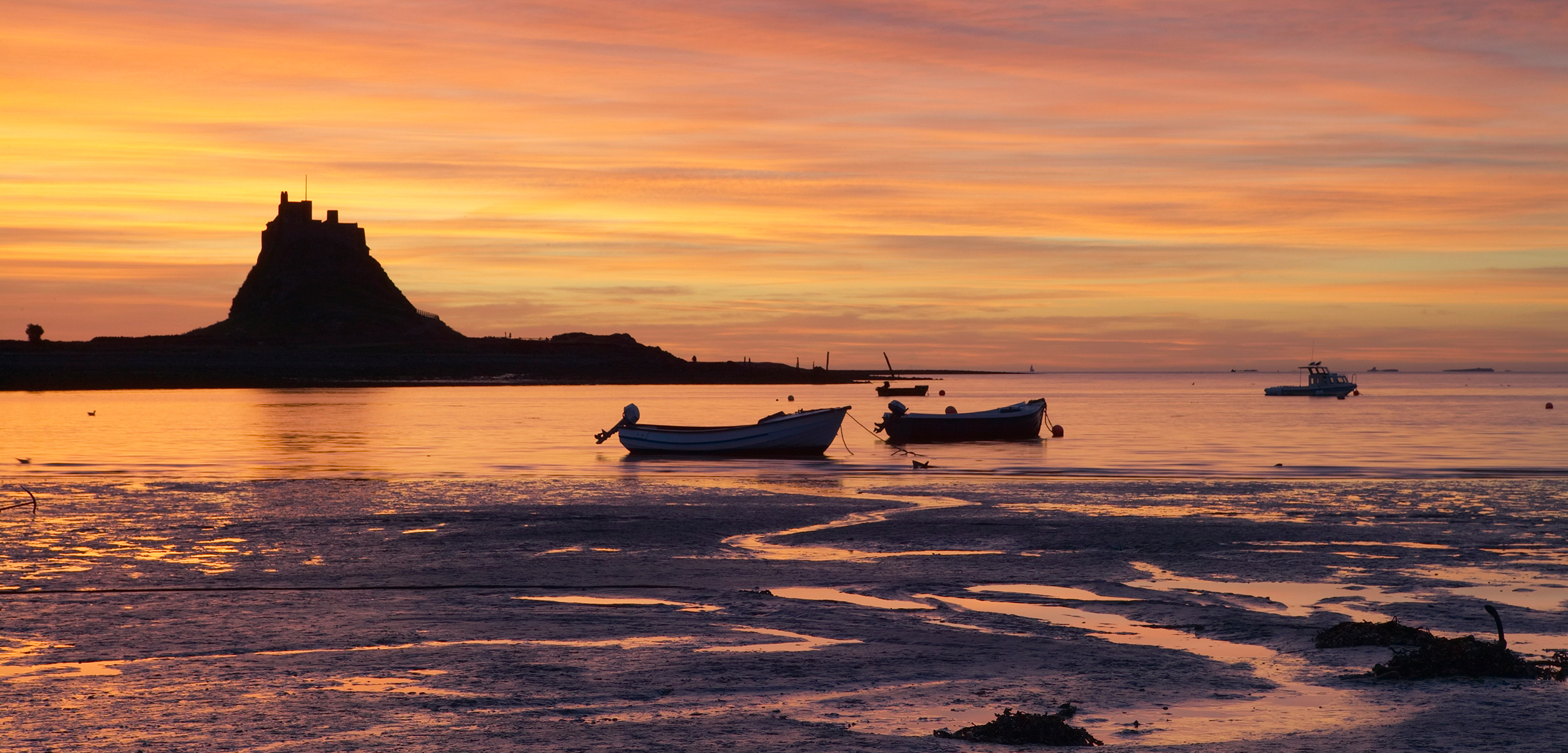
The Holy Island of Lindisfarne, off England’s northeast coast, appears and disappears twice daily. Rising tides transform the peninsula into an island, flooding the 2.5-kilometer-long causeway connecting it to land. On average, safe passage lasts about seven hours. The sometimes-island has drawn travelers both peaceful and warlike, beginning with Irish Saint Aidan. He founded Lindisfarne monastery in 635 CE, choosing the site in part for its unique isolation. But the monastery’s wealth (including illuminated manuscripts and precious ornaments and relics) also attracted the Vikings, who made their first-recorded invasion of Britain at Lindisfarne in 793 CE. Today, the holy isle attracts tourists, who must monitor the tide tables or risk getting stranded.
Volcanoes
Submerged eight meters beneath the sea surface off Italy’s southwest coast is an underwater volcanic island with multiple names: Graham in Britain, Ferdinandea in Italy, and Julia in France. The island’s multiple identities mirror its convoluted history. When it was exposed in 1831, British naval officers claimed it, as did the Kingdom of Two Sicilies (unified Italy didn’t yet exist), Spain, and France, resulting in diplomatic struggle. Magma chambers in the earth’s crust beneath the island can inflate and deflate, lifting or lowering the island, and by 1832, it was submerged once more beneath the waves. The island’s 1863 reappearance was so short-lived, no one had time to lay official claim. The island remains submerged until future volcanic activity raises it and creates renewed fervor.
Pumice Rafts
Perhaps no other island on Earth has confused cartographers as much as Sandy Island. The 25-kilometer-long island was first sighted by French sailors in 1876, west of New Caledonia, and appeared on maps of the South Pacific for more than 100 years. However, scientists mapping the area in 2012 found no sign of the mystery island; the sea beneath its supposed location was approximately 1,400 meters deep. Data from a 2001 underwater volcanic eruption near Tonga suggested an answer: buoyant, air-filled pumice ejected during the eruption formed “rafts” on the sea, dozens of kilometers wide, which drifted more than 3,000 kilometers and passed close to Sandy Island’s “location” before disintegrating. Researchers now think Sandy Island could have been such a raft.
River Deltas
New Moore Island appeared in the Hariabhanga River delta after the 1970 Bhola cyclone. Small islands regularly form and erode in river deltas, but New Moore was uniquely situated on the contentious border between India and Bangladesh (where people called it South Talpatti Island). At only 3.5 kilometers long and three kilometers wide, the island drew attention because it sat in the oil-rich Bay of Bengal. Both nations claimed ownership, and Indian soldiers raised a flag on its shores in 1981. The conflict was definitively settled in 2010, when rising ocean levels caused in part by climate change submerged New Moore.